Ç Z M - Ç A T A L H Ö Y Ü K Z İ Y A R E T Ç İ M E R K E Z İ
C Z M - Ç A T A L H Ö Y Ü K V I S I T O R C E N T E R
Anatolian Plateau Konya Basin +
UNESCO World Heritage Neolithic Site of Çatalhöyük's Visitor Center
Landscape Architecture Project : Drought Landscape +
Bioswale + Stone Masonry
+ W/out supervision construction updates are below + Çumra, Konya TR + 3.2 ha
+ 2019 + 2020 + Completed Project
+ Owner Konya Büyükşehir Belediyesi Konya Metropolitan Municipality
+ Collaboration + Mehmet Kütükçüoğlu Ertuğ Uçar Teget Architecture
+ Collaborators + Engin Gürcan + Aydın Akar
+ Coordination + MEP + Infrastructure + Fire + Irrigation + Lighting + Budget
+ Architectural Intern + Mert Alexander Kretschmer
+ Architectural Photography + Egemen Karakaya

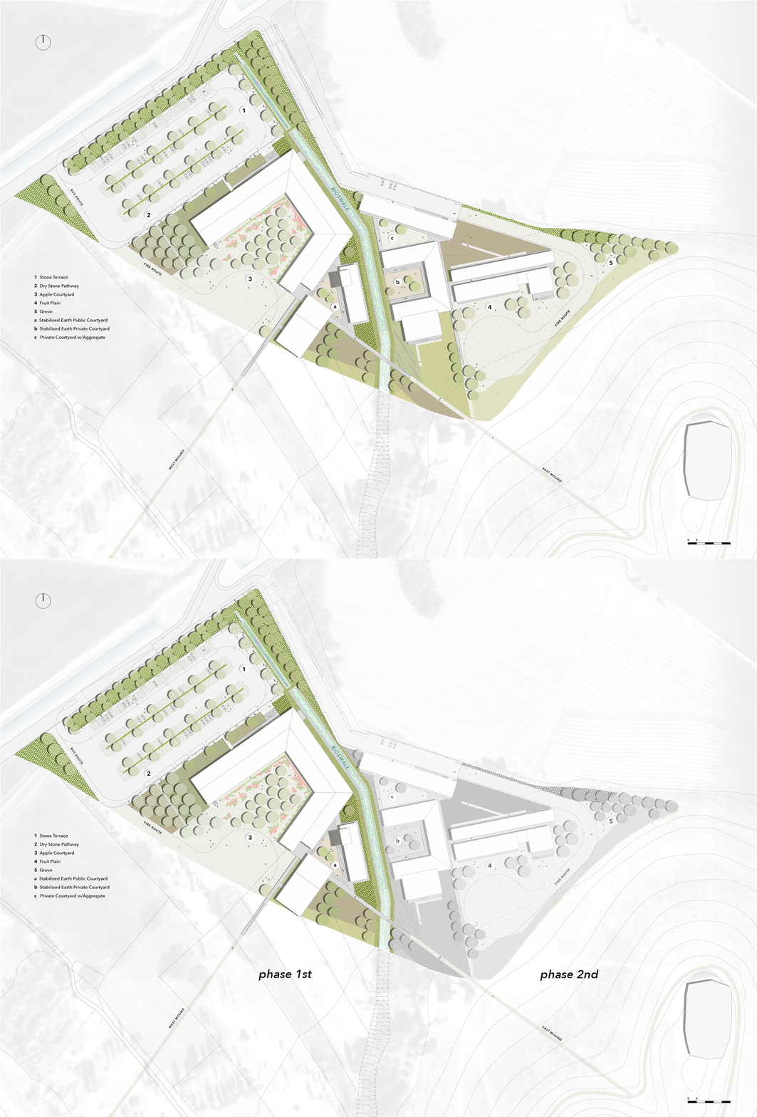
While the Konya basin is struggling with drought, the geography not ready for climate change with the change of water regime. The region is also devoid of local trees, and in the region where agricultural activities are active, only a few trees can be seen even at the borders of the fields. In such a case, the landscape architecture approach for all living things, including humans, was primarily to reduce areas of direct sunlight and to develop a plan strategy that would prevent rapid evaporation of surface waters. The creek ditch, where there is no water anymore, has been preserved, and new plant species have been added so that biodiversity can occur along this ditch as a bioswale which can collect the waters of irregular and decreasing rains.
For this public and low budget project, hardscape materials that are natural and at peace with the soil were chosen, along with dry land and bioswale plants. Light-colored natural stones and aggregate types, materials such as sandstone that retains moisture, soil stabilization to keep the courtyards cool, methods such as mortarless dry stone application and geotextile-free ground layering were preferred for the propagation of plant seeds. In these preferences, the nature of the region, rural routine and suitability for the archaeological site were basics and important criteria.


1 Bus and Car Park
2 Stone Terrace
3 Bio-Pool turns to Bioswale Corridor
4 Concrete Water Structure
5 Çumra Road

BIOSWALE Corridor Planting Scheme (Coloured layers are based on the perspective BW image of TEGET)
Bioswale as a water infrastructure behaves like a corridor which is settle on physically to the topography's existing historical and natural waterway characteristics.

1 Tree Canopy as a stop for pedestrians w/cobblestone and sandstone between the vehicles
2 Bioswale for stormwater
3 Cobblestone pavement for vehicles linked with bioswales